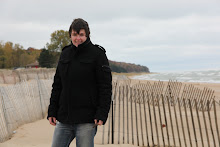
Killing Season Chicago, Wicker Park, July 2011


Click on the names of the deceased on the right navigation panel to see images of the sites and information about the circumstances of their deaths.

Thursday, February 3, 2011

Time of Incident Statistics


We all have percieved notions about what time of day is safest to be out and about, especially in neighborhoods that see high crime. I took times that each of the homicides occurred and made a chart showing when the most incidents happened. Here are the results.

click image to see larger version

Friday, January 28, 2011

Best Week on Record


For those of you that live in Chicago and do your daily commutes on the trains or busses, you probably pick up the RedEye to pass the time on the way to your destination. If so, you most likely notice that each Thursday, they publish a map showing all the homicides in the city for the week along with the dates, addresses, and causes of death. This past week there was only 1 homicide in the City of Chicago.

As quoted from the article above, "RedEye has never published a homicide map with just one victim since the newspaper began printing homicide maps in February 2009." There was a six day span between the last two homicides, which is recently unheard of in Chicago.

19 homicides have been recorded so far for the month of January 2011, just one less than least year with a few days to go.

While it is unfortunate that there was even one death, it is exciting to see such a quiet week.

Here is a link to the RedEye Homicide Tracker.

Thursday, January 27, 2011

Most Dangerous Neighborhood in the Country

Please bear in mind that this statistic is according to WalletPop, which describes itself as a friendly consumer finance site who's mission is to help you manage your money and understand how the important stories of the day affect your wallet. This particular article "25 Most Dangerous Neighborhoods 2010" is tagged with the key words home, insurance, and real estate. So believe what you will about the accuracy of the information, but regardless it is still an interesting tid bit.

According to this article Chicago hold the #1 most dangerous neighborhood in the country.
(We are also on the list at #18 for another area as well.)


The bounderies for the area are Kinzie Street to the north, Damen to the east, Washington Boulevard to the south and Western to the west. The statistics for the area are as follows:

Predicted annual violent crimes: 297
Violent crime rate (per 1,000): 257.72
Chances of becoming a victim here (in one year): 1 in 4*

Neighborhood median housing value: $323,216
School District Rating: 12%

Not one of the 168 people who were killed in the City of Chicago over the summer months was killed in this area.

Here's the info for #18:


The bounderies for this area are as follows: Pershing Road to the north, State Street to the east, 43rd Street to the south, and La Salle to the west.

Predicted annual violent crimes: 202
Violent crime rate (per 1,000): 93.04
Chances of becoming a victim here (in one year): 1 in 11*

Neighborhood median housing value: Not available
School District Rating: 12%

Only one of the 168 people killed in the City of Chicago this summer was killed in this area. His name was Bennie Madison.

*(Average in Chicago: 1 in 17)

Tuesday, January 25, 2011

No Parking Zones


As I was photographing this summer, I began to notice that many of the locations where people were killed in vehicles were in no parking zones, either in front of fire hydrants or in the yellow curbed areas at the end of most blocks in Chicago. All of them were killed while sitting idly in their vehicles. Most were accompanied by other people. After taking a closer look at these statistics, I found that 18 people were killed in vehicles this summer. Of those 18, 3 were shot and killed while driving and 6 were parked in front of their own homes. Of the remaining 8, 6 of them were sitting in a car in an illegal parking zone. The conclusion I came to is that those victims were waiting for something or someone and pulled into the empty spot on the street in the meantime. That would explain why so many were not only parked illegally, but also sitting in their cars. I don't really know what this information means, but I do thinkn it is an interesting statistic to add to the discoveries I made this while photographing this project.

To see the locations of those killed in no parking zones, click on the "No Parking" label on the side bar.

Wednesday, January 12, 2011

George Esco, 57


On July 10th at about 8 p.m., George Esco was victim of battery on the sidewalk at 5345 West North Avenue. He was declared dead seven weeks later on August 28th at 12:30 a.m. at Holy Cross Hospital. Following an autopsy, the medical examiner's office determined his death was a homicide, and that he died of head injuries from blunt head trauma in an assault.

Photographing at the site

Monday, January 10, 2011

Terrance Jackson, 34


Terrance Jackson was on the street at 4458 West Wilcox Street in the West Garfield Park neighborhood at about 1:10 a.m. when two male assailants approached and fired shots, striking him in the chest. He was taken in critical condition with multiple gunshot wounds to Mount Sinai Hospital, where he was pronounced dead at 1:46 a.m.

Photographing at the site

Sunday, January 9, 2011

Jennifer Alvarado, 20s


Jennifer Alvarado was shot and killed while in a vehicle in the Southwest Side's Little Village neighborhood. Jennifer was a passenger in the front seat of the vehicle as it was headed west on West 24th Street about 5:30 p.m. on September 6th when another vehicle pulled up at about 2718 West 24th Street and fired shots.

Photographing at the site